On phase one of the project I came into conclusion that any memory driven intervention in Warsaw should have a significant spatial presence, preferably one which is spread on a large area. I also felt that referring to the physical aspect of the past may be more objective than mere reference to an event, where relation to certain narratives and myths is inevitable.
Thus I started to deepen my understanding of Warsaw urban development. The amount and quality of material, much of it available online, is outstanding. Endless bits of information forming images, videos and texts create an unbelievable picture of both pre-war, during the war, and post-war Warsaw, and especially enhance the amazing contradiction between the urban characteristics – both physical and humane – of current Warsaw and pre-war Warsaw.
Pre War
Here are some videos showing pre-war Warsaw:
The following is a rare color film from May 1939 by Benjamin Gasul showing the Jewish Quarter
From the abundant material on the Internet and the various available projects, books, clips, forums, collections, films, opinions and discussions, it is obvious that people honestly miss and crave for pre-war Warsaw and vigorously deal with pre-war life in the city.
Here are some links: “Warszawa Przedwojenna” (“Pre-war Warsaw”) Facebook Page, with over 30,000 likes already; the amazing “Pre-war Google Street View” of Warsaw: “Warszawa 1939”; the 3D animation film “Warsaw 1935”; Pre-war photo collection in SkyScraperCity forum.
Life, as opposed to death, was the most dominant characteristic of prewar Warsaw, rich life of work, study, culture, communities, encounters. Dense urban tissue was a physical field on which such life could grow and prosper.
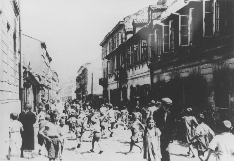
Continuous building lines created by adjacent building blocks formed distinct streets, such as Krochmalna street seen in this photo:
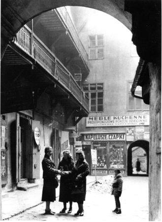
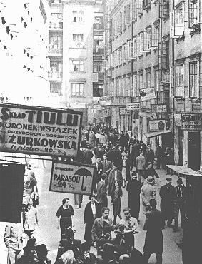
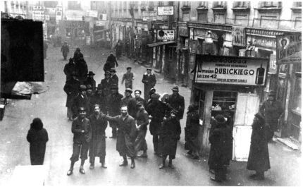
Building blocks were square or rectangular containing inner courts that served as a miniature urban nerve system, surrounded by shops, workshops, restaurants, warehouses, inns and apartments.
Here are some amazing photos from such courtyards on Nalewki street:
Mixed use, a dream of any urban planner and designer today, vastly existed to a level of a building, and together with rich commercial streets and dominant squares, created a unique urban vitality. Even when the area turned into a Ghetto, life momentum continued when endless local initiatives supporting the poor could be contained in this tissue. This very same dense built environment enabled people finding hiding places in Ghetto times and rebellions.
Post War
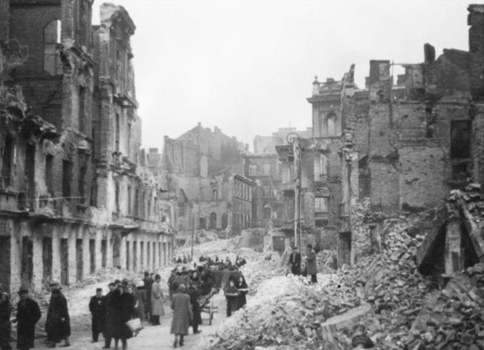
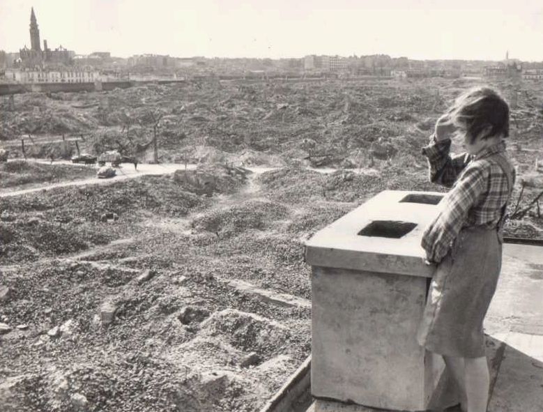
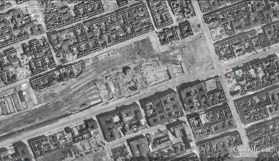
Although I decided to focus on pre-war life as an inspiration and generator, shocking images of post-war Warsaw cannot be ignored. One cannot believe the vast destruction of built environment that followed mass murder of the innocent.
World War II Fatalities in Poland: Jewish: 2.7-3 million. Polish: 2-3 million.
Warsaw lost over 10,000 buildings, 85% of the city.
The following image symbolizes the complete destruction of the northern areas of Warsaw, where the Jewish neighborhoods and later the Ghetto used to be
“Warsaw has to be pacified, that is, razed to the ground” Adolf Hitler, 1944
Visual aerial timeline
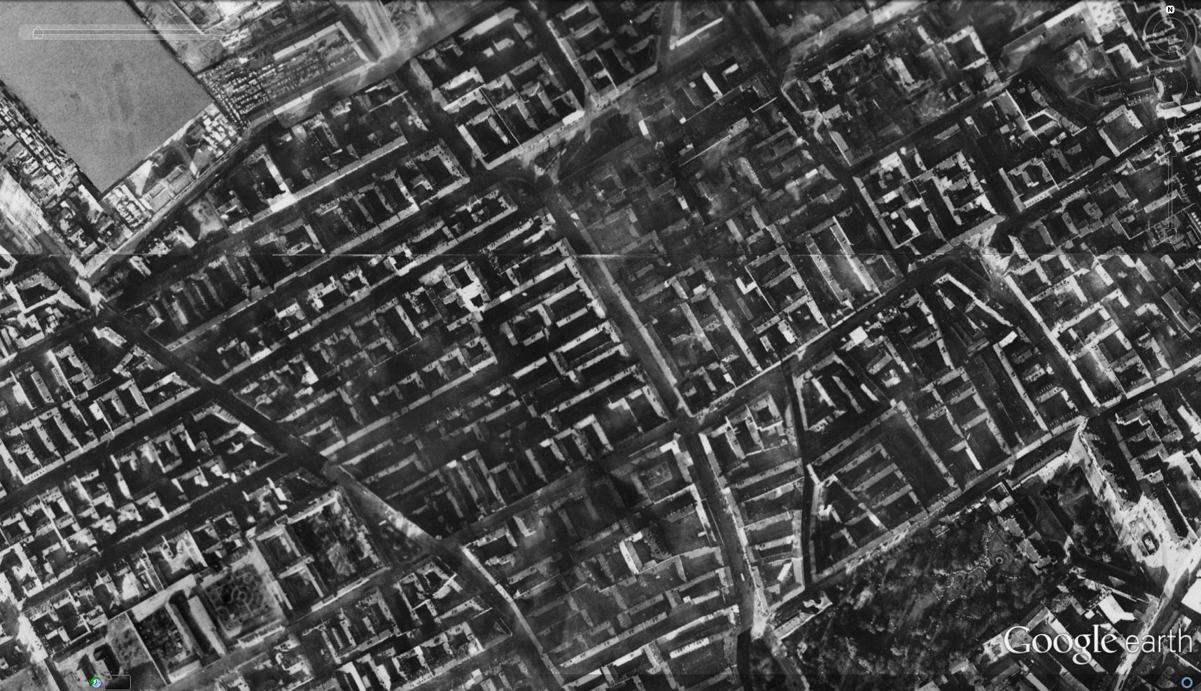
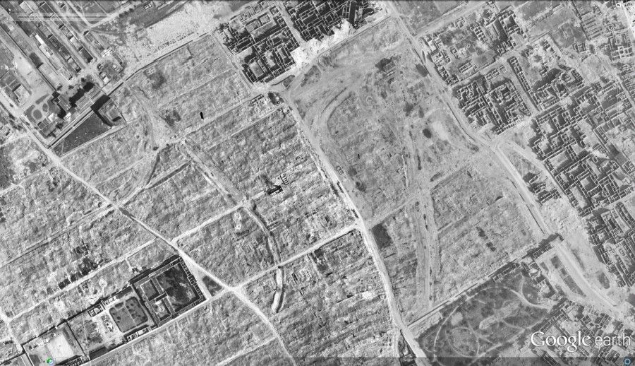
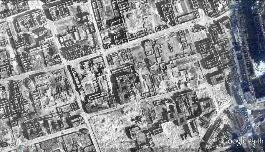
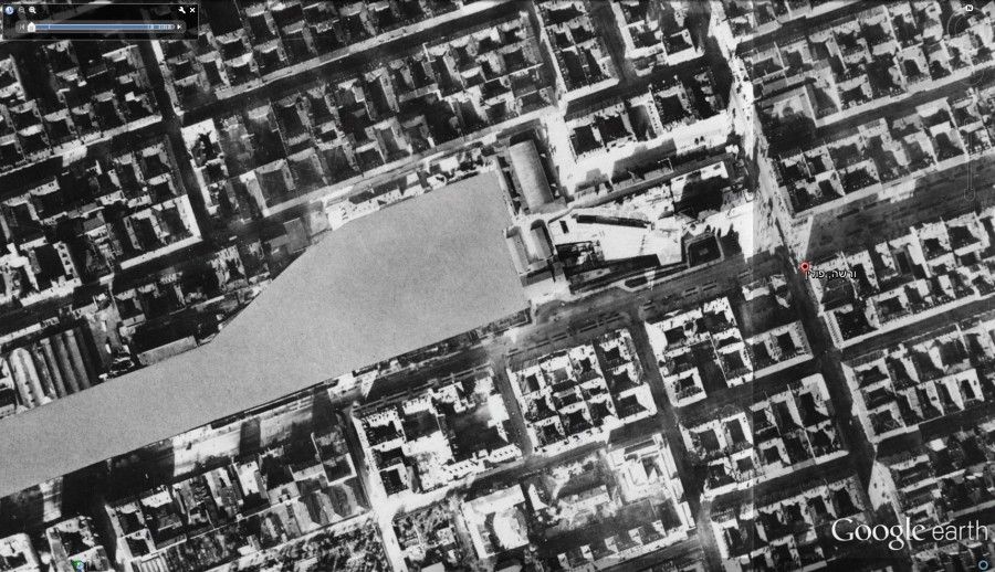
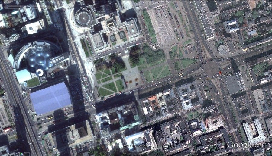
A powerful evidence to the immense difference between pre-war, post-war and current Warsaw can be found via Google Earth, which provides an aerial view of Warsaw in 1935, 1945 and currently.
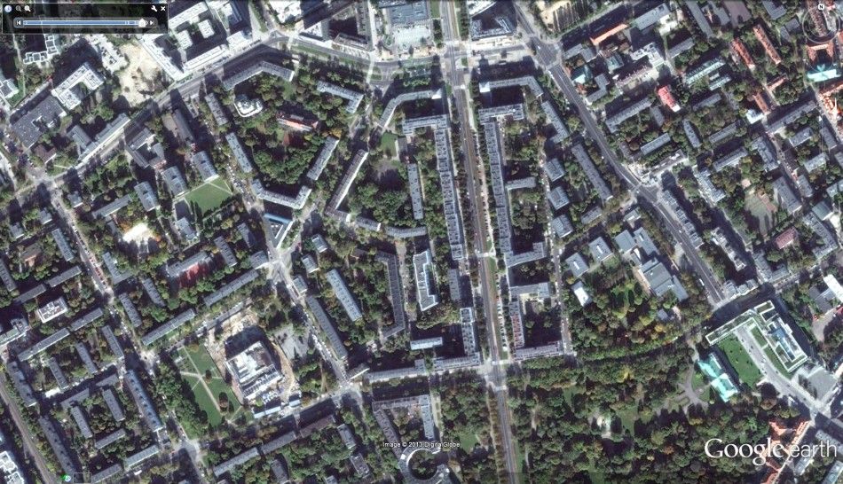
Let’s take a look at a certain area in Muranów. Muranów was the main Jewish quarter of Warsaw.
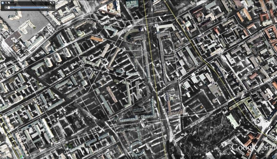
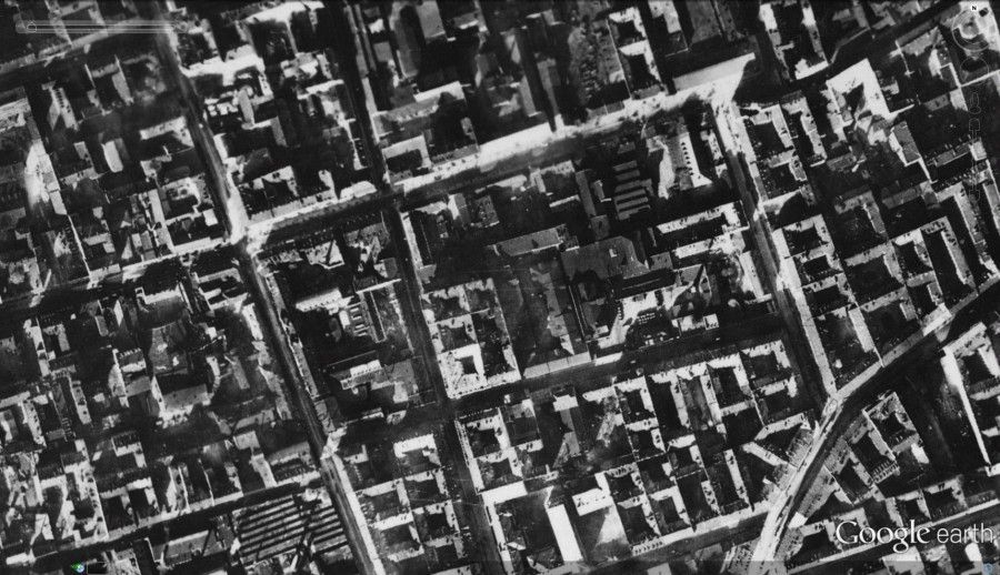
That’s how it looked like in 1935. Plac Muranowski, an important commerce and transportation hub, is seen in the middle upper part of the photo. Nalewki St., an important urban artery, stretches south. The Diagonal street is Zamenhofa. The disguised area on the upper left part is the railway tracks that will later serve the Umschlagplatz – the deportation square.
Note how building blocks actually shape the streets.
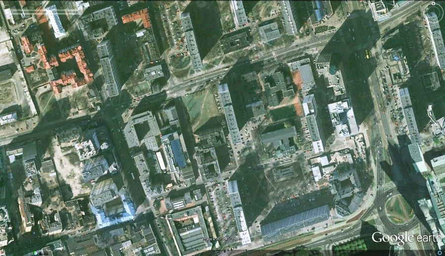
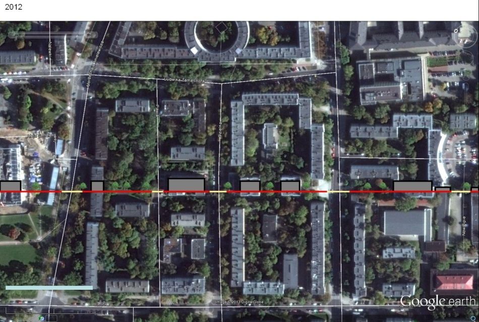
and here it is today. In this part of Warsaw both streets layout and building shapes changed.
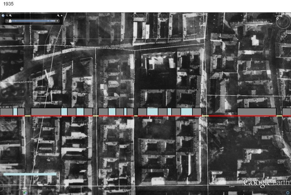
As all Warsaw buildings are 3D modeled in Google Earth, we can see current buildings on top of the 1935 aerial photo. Muranów was rebuilt after the war in modern / socialist realism architectural style, characterized by long residential slabs nestled in large open areas.
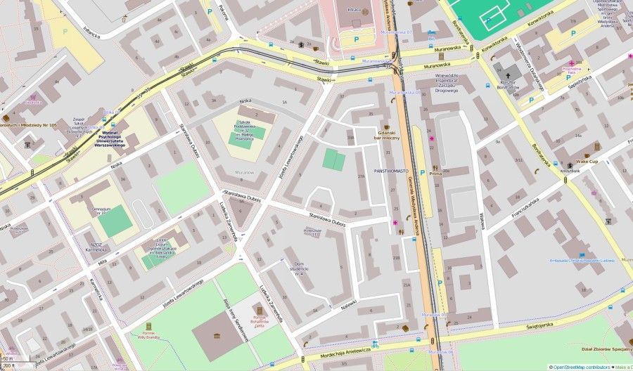
And again the same area as represented today in Warsaw Municipality GIS map. Note that current streets are no longer shaped by building lines. Streets are merely lines between almost arbitrarily located buildings, containing roads for cars and separate paths for pedestrians. The whole meaning of streets in Muranów has changed after the war.
“A dull space between apartment buildings, it reveals absolutely no link with the past.” Angelika Lasiewicz-Sych in Stacja Muranow
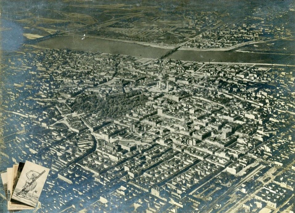
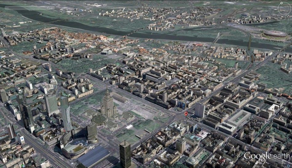
Here is a diagonal aerial photo of pre-war Warsaw:
Let’s take a look at another area, this time – around Waliców St., where several buildings survived the war.
1935:
1945:
Current:
and another trio – Central train station area.
1935:
Current:
Some analyses
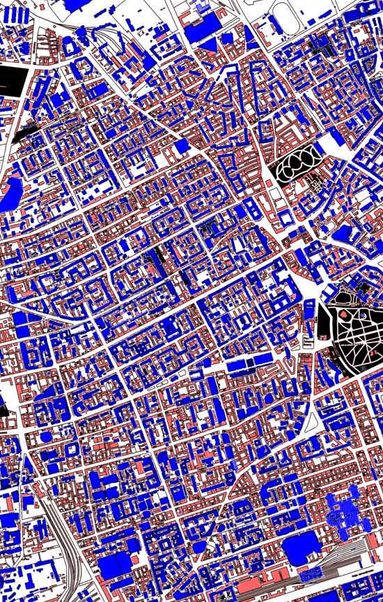
In the following image we can see built up areas of Warsaw – red for pre-war and blue for current. Note how dense was the classical urban tissue as opposed to the sparse buildings that characterize current Warsaw
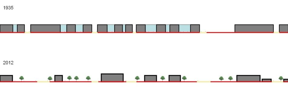
Here’s a sample section in several blocks and streets of pre-war and current Muranów:
Life conditions in the dense pre-war urban blocks of Warsaw was not always easy. High population density in poor areas brought up voices who called for rebuilding some areas even before the war. Plans for current Aleja Jana Pawła II existed before the war. But today, as a dense city becomes almost a synonym for desired quality of life, pre-war Warsaw blocks seem like an interesting urban tissue to be inspired from.
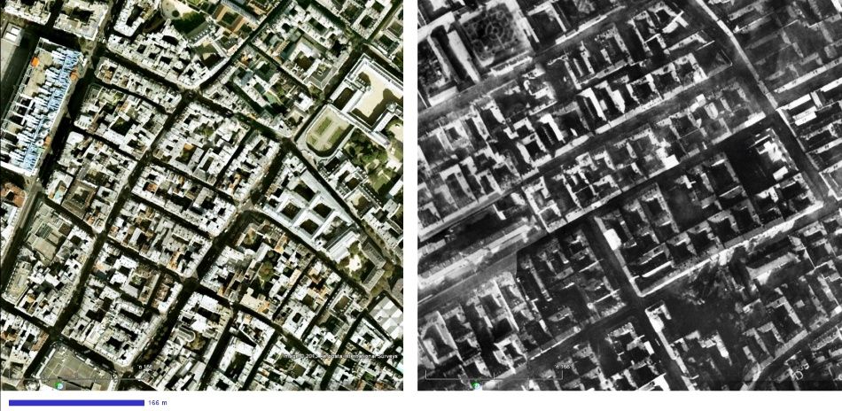
… and let’s take a look at urban blocks in Paris: presented here side by side with Warsaw blocks in the same scale, current Paris blocks seem even more dense.
Conclusion
As a conclusion, it strengthen my notion that an intervention in current Warsaw should be inspired by the past, by urban life characteristics before the war. Life in a vibrant city of vibrant communities. It is dealing with life should be commemorated rather than death. Death and destruction was vast but limited to a certain period and was a colossal event. This event is today the main subject of commemoration in the public areas of Warsaw: places where the Ghetto wall used to be; places where rebels fought; the place from which Jews where sent to death camps…
But life of the Jews and other communities of the city do not get any shape in the current space of Warsaw. Ironically they are represented inside a newly built 65X65 meters cube in Muranów . This explains why while walking in Muranów streets in 2012, feeling enormous void, I felt angry as I was approaching the Jewish Museum. Rich life took place inside amazing urban tissue right here, everywhere! Squeezing it into a fancy cube which totally ignores urban tissue that existed in this very place, seemed to me insensitive.
4 Responses
Guest
The old Jewish streets (and parts of buildiongs) are still there. The whole new Muranow area is very high above the ground. It has been set on the top of the pre war ghetto rubble. Here you can see the difference. http://wawago.blox.pl/resource/New_IMG_5819.jpg
Miguel Simões
Hello,
I’m a student at Faculty of Architecture of University of Porto (Portugal) and I’m starting my master degree thesys on “The reconstruction of Europe after WWII”.
For that I intend to study the evolution of two cityes (pre, during and after war), maybe one in Germany and one in Poland, or two in Poland.
For now, my research as been focused on Wroclaw and Warsaw, and this blog as the kind of information that I’m aiming for, so congratulations on your work!
I would like to know if you could provide me any kind of tips, clues and information.
Thank you for your attention,
Miguel.
Angelika Lasiewicz-Sych
Hello,
I found it interesting how you comment on Warsaw’s history and how you have fit in my words.
Best_
Angelika L-S
Elana Milman Israel
Hi,
My name is Elana Milman, was born as Helena (Hela) in Bergen Belsen (DP Camp 1947), My Mother Franca (Franya) Lewinska (Syten) was born in Warsaw’ (3.5.1918), lived in at wolominskastraaBe 56, Warsaw. Her family perished in ghetto Warsaw or Treblinka, she smuggled out of the ghetto and survived few years on the Aryan side. I did a life time research tracking her life story. Your tangible research has revealed to me eye-popping images. I wold love to know more about her street; stores, bakeries to get familiar with her childhood style. her father Moshe Syten had a textile store. I have heard about the movie Moranow which explained how the area was rebuilt from the ruins and bones of the perished people, that were used to create the bricks for construction, can you help me to get access to this film? And expend my searching about actual life in my mother’s place of leaving?
Thank you so very much for your great information with such clear visual facts.
Elana Milman, Israel